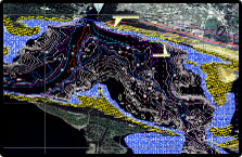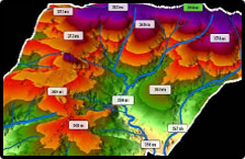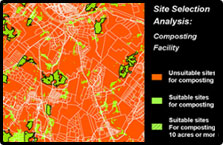
GIS has become an integral and indispensable tool for planning and analysis, offering remarkable utility for land use, environmental, and infrastructure applications. Integration of GIS and engineering facilitates in improvising decision making with reduced time effort and ensures cost optimization.
National Spatial Data Infrastructure (NSDI), National Remote Sensing Centre (NRSC) & Bhuvan is playing a key role in advancing the use of GIS and geospatial technologies in the infrastructure sector.
 |
 |
 |
GISCON Engineering provides a wide range of GIS capabilities to meet our clients' needs. From the preparation of alternative land use scenarios to the spatial analysis of their environmental impacts, GISCON Engineering has the skills and knowledge to apply GIS technology to solve challenging Engineering problems and provide critical information to decision-makers in private, public, and institutional settings.
Corridor Identification – Identification of different routing, route alignment study led to selection of best techno-economic route to avoid physical, environmental and land acquisition hurdles. Comparison of routes is done etc :
|
|
Drainage Pattern – Identification of drainage pattern/flooding scenario and suggest alternative routes.
Facility location finalization: Facilities are finalized considering soil strata, wind direction and minimum cut fill analysis with optimum quantity of cutting, filling and compaction required.
GIS database Development – DGPS based Topographical survey data and collection of other early investigations and organize a wide range of spatial data on GIS platform. Real world features are geographically referenced according to the highest standards for positional accuracy. Physical features are located with GPS (Global positioning system) based on LIDAR land survey / foot survey,
3 D Visualization – GISCON Engineering offers 3-D visualisation and analysis. 3 D model of sub surface conditions like soil/ rock type with varying depth, water table result in finalization of facility i.e. building, structure & reservoir. With the use of 3 D simulations, Client can also visualize the alternative development scenario and various stages of the project.
Web hosting of GIS data (Intranet/ Internet) – Creation of Centralised Web GIS database to enable users to view updated spatial data to all to view real time like supply / demand of existing, rehabilitation & remedial requirement.